In spaceborne GNSS-R systems like CYGNSS (Cyclone Global Navigation Satellite System), coherence observation is a crucial measurement used to retrieve geophysical parameters of the Earth’s surface. Coherence is a measure of the similarity or correlation between the transmitted GNSS signal and the received signal after it has interacted with the Earth’s surface (e.g., lake ice, ocean, soil, vegetation, etc.).
Here’s how coherence observation works in spaceborne GNSS-R systems like CYGNSS:
- Transmitter and Receiver: GNSS-R systems consist of a constellation of satellites equipped with GNSS receivers (receivers) and transmitters (transponders). The GNSS satellites transmit signals towards the Earth’s surface.
- Interaction with Earth’s Surface: The GNSS signals, when they encounter the Earth’s surface, undergo various interactions such as reflection, scattering, and absorption.
- Reflected Signal Acquisition: The GNSS-R satellites’ receivers capture the signals that are reflected or scattered back from the Earth’s surface.
- Coherence Measurement: The coherence is then calculated by comparing the phase and amplitude of the received signal with the transmitted signal. Coherence provides information about the quality of the received signal and how well it correlates with the transmitted signal.
- Parameter Retrieval: The coherence information, along with other GNSS-R measurements, is used to retrieve various geophysical parameters of the Earth’s surface. In the context of lake ice monitoring, coherence observations can help in characterizing the state of the ice, such as its thickness and roughness.
- Data Processing and Analysis: The coherence data, along with other measurements, are processed and analyzed to generate useful geophysical products and maps that researchers can use for lake ice monitoring and other environmental studies.
By studying the coherence of reflected GNSS signals, researchers can gain valuable insights into various environmental parameters, making GNSS-R an important tool for Earth observation and monitoring.
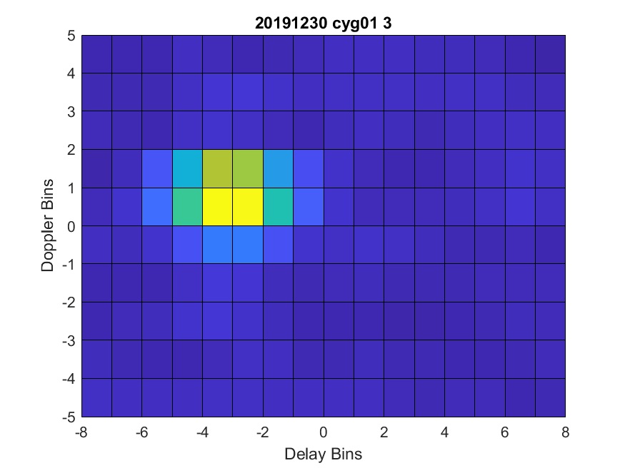
The reflective surface texture of the Earth’s surface, such as lake ice, can significantly affect the coherency of the reflected signals in spaceborne GNSS-R systems like CYGNSS. The surface texture plays a crucial role in determining the scattering and reflection properties of the GNSS signals, which, in turn, influence the coherence of the received signals. Here’s how the surface texture impacts coherency:
- Roughness and Specularity: The surface roughness of the reflective medium, in this case, the lake ice, determines the scattering behavior of the reflected GNSS signals. Rough surfaces can scatter the signals in various directions, leading to reduced coherence, as the phase and amplitude of the received signals become more scattered and less correlated with the transmitted signals. On the other hand, smoother surfaces with less roughness tend to have more coherent reflections, as the signals maintain their original characteristics to a higher degree.
- Depolarization: The surface texture can cause depolarization of the reflected signals. Depolarization occurs when the orientation of the electric field of the reflected signal becomes randomized due to surface roughness or scattering mechanisms. This depolarization can lead to a reduction in coherence since the original polarization characteristics of the transmitted signal are no longer maintained in the received signal.
- Multiple Scattering and Interference: In some cases, the reflected GNSS signals may experience multiple scattering events due to complex surface structures. These multiple scattering events can lead to interference patterns, causing reduced coherence in the received signals.
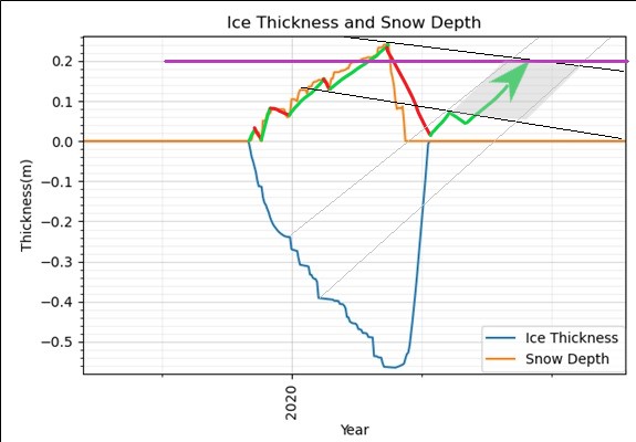
- Melting and Refreezing of Ice: In the context of lake ice monitoring, the surface texture of the ice can change due to melting and refreezing processes. When ice melts and refreezes, its surface can become rougher, leading to changes in the coherence of the reflected GNSS signals over time.
- Snow Cover and Surface Liquid Water: In the case of lake ice, the presence of snow cover or surface liquid water can also affect the surface texture and, consequently, the coherency of the reflected signals. Both snow and water can introduce additional scattering mechanisms that influence coherence.
During the transitioning times when the lake state changes from open water to lake ice and vice versa, the coherence of reflected GNSS signals in a spaceborne GNSS-R system like CYGNSS can be expected to undergo significant changes. These changes are primarily influenced by the differences in the surface properties and scattering mechanisms between open water and ice. It’s important to emphasize that the coherence of reflected GNSS signals is influenced by multiple factors, including surface roughness, dielectric properties, surface liquid water, and snow cover, as mentioned in my previous response. Wind-driven roughness during open-water conditions is one additional factor that can affect the coherence and should be considered when studying the lake’s behavior during the transitioning times from open water to lake ice.