
Recently, a GNSS-IR analysis software has been published online offering a handy graphical user interface, which tends to become a popular alternative to existing software packages and tools. This MATLAB-based open-source software package is GIRAS.
GNSS-IR has become a robust method to extract the characteristic environmental features of reflected surfaces, in which, fluctuations in the strength of the signal received by the GNSS receiver are analyzed. A short video was created and posted here showing how fluctuations in reflected SNR relates to altimetric applications. Frequency, amplitude, and phase values that provide the most appropriate model of the changes in signal strength are used as GNSS-IR metrics. Although there are several different software packages currently available to find these metrics, they may be insufficient in some cases.
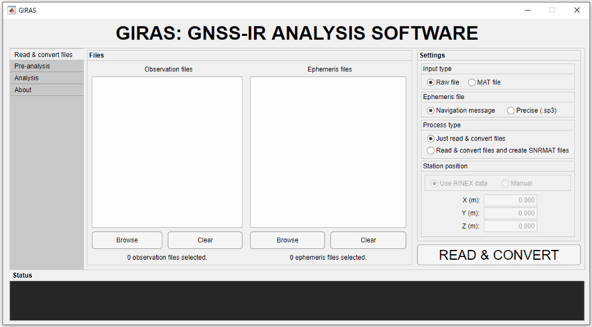
Newly, a MATLAB-based, open-source GNSS-IR analysis software (GIRAS), developed by Cemali Altuntas and Nursu Tunalioglu from Yildiz Technical University, Turkey, has been published online in GPS Solutions. With its graphical user interface and capabilities, GIRAS is a good alternative to existing software packages and tools. GIRAS has three main modules and five sub-modules. The first main module is “Read & convert files”. This module reads raw GNSS data and stores the necessary observations in the MATLAB environment. RINEX version 2 and RINEX version 3 observation files are supported. Both broadcast ephemeris and precise ephemeris (sp3) files can be used. Multi-GNSS (GPS, GLONASS, Galileo, Beidou) sp3 files are supported.
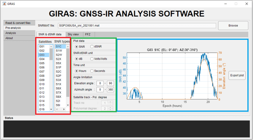
The second main module is “Pre-analysis” which has three submodules: (1) SNR & dSNR data, (2) Sky view, (3) FFZ. Here, the user can plot the SNR and dSNR data for different polynomial degrees for each satellite and signal type. The sky view can be plotted as including the selected satellite systems. The first Fresnel zones (FFZs) can be displayed on the plot screen and Google Earth. The user also can export all graphs as MATLAB figures.
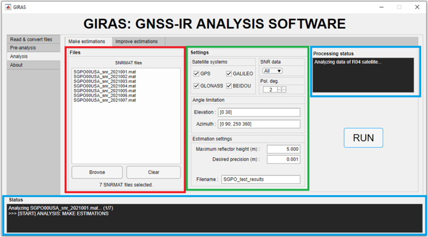
The third main module is “Analysis”, and it has two submodules: (1) Make estimations, (2) Improve estimations. Here, GNSS-IR metrics can be estimated using several options included. In addition, filtering and outlier analysis of the results can be performed. Analysis results can be saved in both TXT and MAT formats.
GIRAS enables the selection of azimuthal and elevation angle masks with multiple range selections for either short-term or long-term GNSS data collected, which may help to predict future models for climatological studies. The software is also suitable for multi-GNSS analysis. The quality-control modules are in a way of multiple choice, in where the researchers can apply options for their aims of use. The output files are well-designed for users in a defined format for further computations.
GIRAS seems to be widely used in future GNSS-IR work, thanks to its functional GUI and many options included.
